HyperAI
Command Palette
Search for a command to run...
EuroSAT 遥感图像数据集
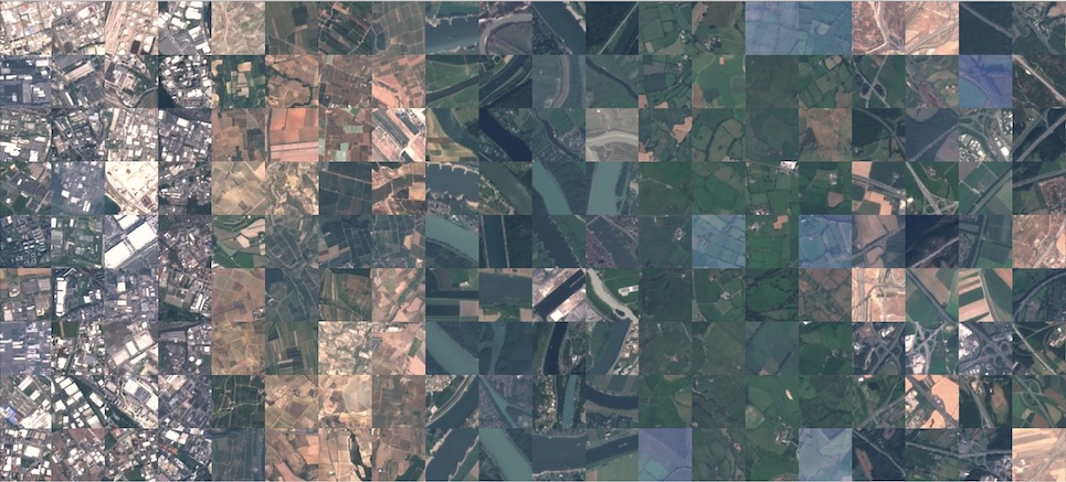
Eurosat 是一个用于土地利用、土地覆盖分类的数据集及深度学习基准。该数据集基于 Sentinel-2 卫星图像,涵盖 13 个光谱波段,由 10 个类别组成,共有 27,000 张有标注和地理参照的图像。每一种场景类别包含 2,000~3,000 张遥感图像,每张图像尺寸大小为 64 × 64 像素。 数据集包含以下 10 个类别:
- Industrial Buildings 工业建筑
- Residential Buildings 居民楼
- Annual Crop 庄稼作物
- Permanent Crop 永久性作物
- River 河
- Sea & Lake 海洋湖泊
- Herbaceous Vegetation 草本植被
- Highway 高速公路
- Pasture 牧场
- Forest 森林
Citation
@article{helber2019eurosat,
title={Eurosat: A novel dataset and deep learning benchmark for land use and land cover classification},
author={Helber, Patrick and Bischke, Benjamin and Dengel, Andreas and Borth, Damian},
journal={IEEE Journal of Selected Topics in Applied Earth Observations and Remote Sensing},
year={2019},
publisher={IEEE}
}
EuroSAT.torrent
做种 1正在下载 0已完成 986总下载量 1,430
此数据集由社区用户贡献,仅用于教育和信息目的。如有任何内容涉及版权侵权,请通过 support@hyper.ai 联系我们,我们将及时审核并删除。