HyperAI
Command Palette
Search for a command to run...
4x Satellite Satellite Imagery Dataset
This dataset is a high-resolution satellite image dataset containing pairs of high-resolution (HR) and low-resolution (LR) satellite images, designed for the 4x super-resolution task. The images are distributed in 2 directories:
- HR_0.5m: Contains GeoTIFF files with a spatial resolution of 0.5 meters per pixel
- LR_2m: Contains the corresponding low-resolution GeoTIFF file with a resolution of 2 meters per pixel
All images are geographically aligned and cover the same area, ensuring pixel-to-pixel correspondence between LR and HR pairs.
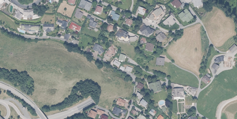
Data Example
4xSatellite.torrent
Seeding 1Downloading 0Completed 45Total Downloads 233
This dataset is contributed by community users and is intended for educational and informational purposes only. If any content involves copyright infringement, please contact us at support@hyper.ai for prompt review and removal.
Build AI with AI
From idea to launch — accelerate your AI development with free AI co-coding, out-of-the-box environment and best price of GPUs.
AI Co-coding
Ready-to-use GPUs
Best Pricing
HyperAI Newsletters
Subscribe to our latest updates
We will deliver the latest updates of the week to your inbox at nine o'clock every Monday morning
Powered by MailChimp