HyperAI
Command Palette
Search for a command to run...
RELLIS-3D Wild Scene Dataset
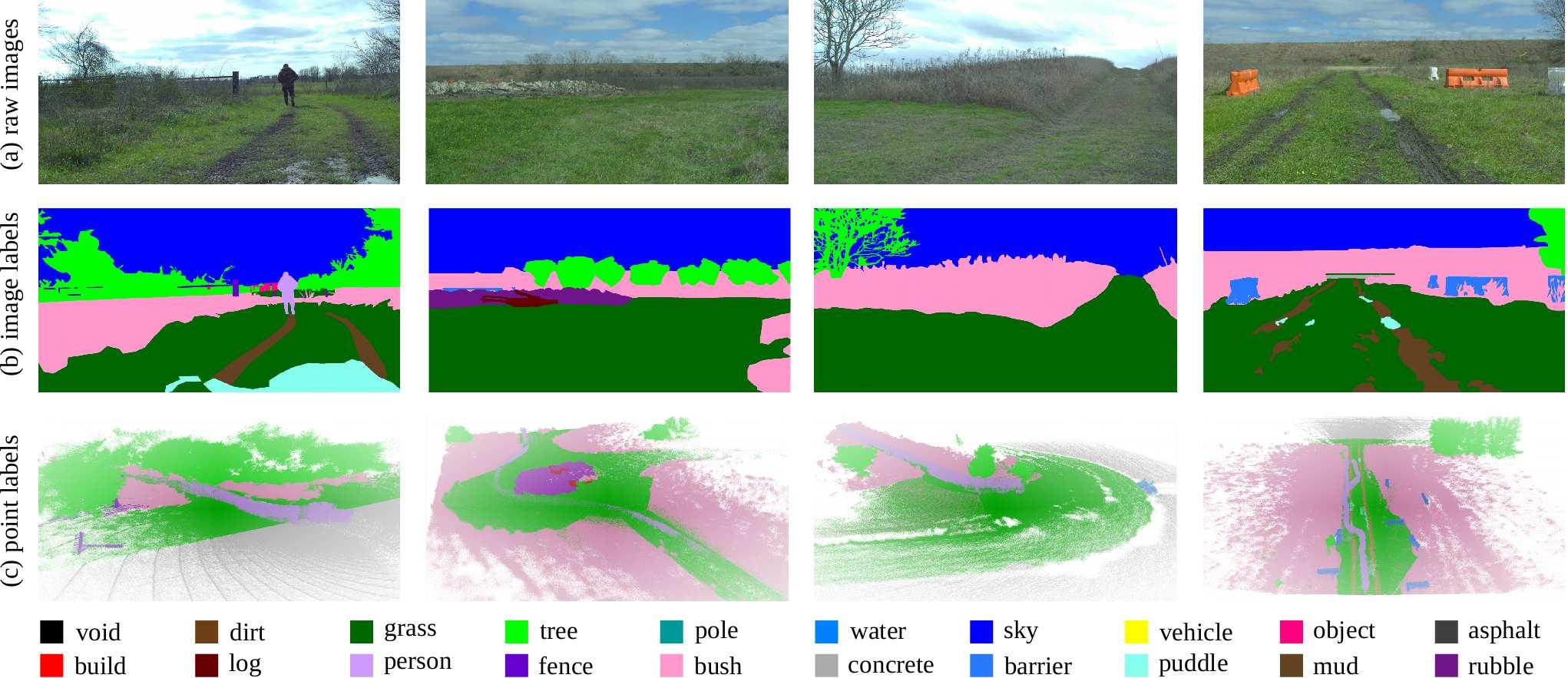
RELLIS-3D is a multimodal dataset collected in off-road environments, containing 13,556 lidar scans and annotations of 6,235 images. The data was collected at the RELLIS campus of Texas A&M University and presents challenges to existing algorithms with regard to class imbalance and environmental topography. The dataset also provides stacked sensor data in ROS bag format, including RGB camera images, LiDAR point clouds, a pair of stereo images, high-precision GPS measurements, and IMU data.
Citation
@misc{jiang2020rellis3d,
title={RELLIS-3D Dataset: Data, Benchmarks and Analysis},
author={Peng Jiang and Philip Osteen and Maggie Wigness and Srikanth Saripalli},
year={2020},
eprint={2011.12954},
archivePrefix={arXiv},
primaryClass={cs.CV}
}
This dataset is contributed by community users and is intended for educational and informational purposes only. If any content involves copyright infringement, please contact us at support@hyper.ai for prompt review and removal.
Build AI with AI
From idea to launch — accelerate your AI development with free AI co-coding, out-of-the-box environment and best price of GPUs.
AI Co-coding
Ready-to-use GPUs
Best Pricing
HyperAI Newsletters
Subscribe to our latest updates
We will deliver the latest updates of the week to your inbox at nine o'clock every Monday morning
Powered by MailChimp